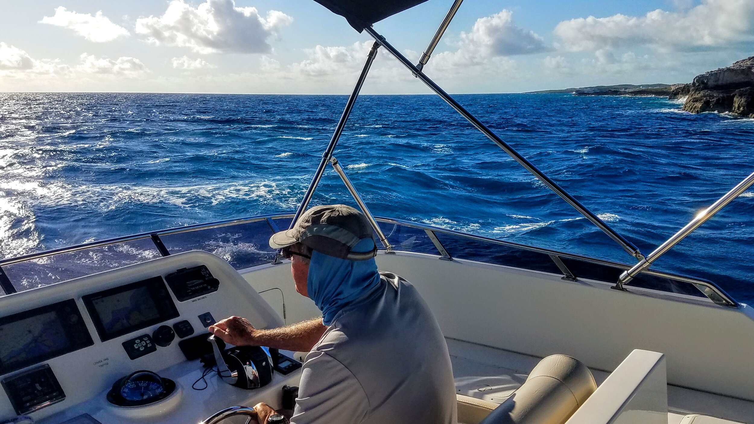
Captain's Post #12 - Cruising During COVID, Key West to California?
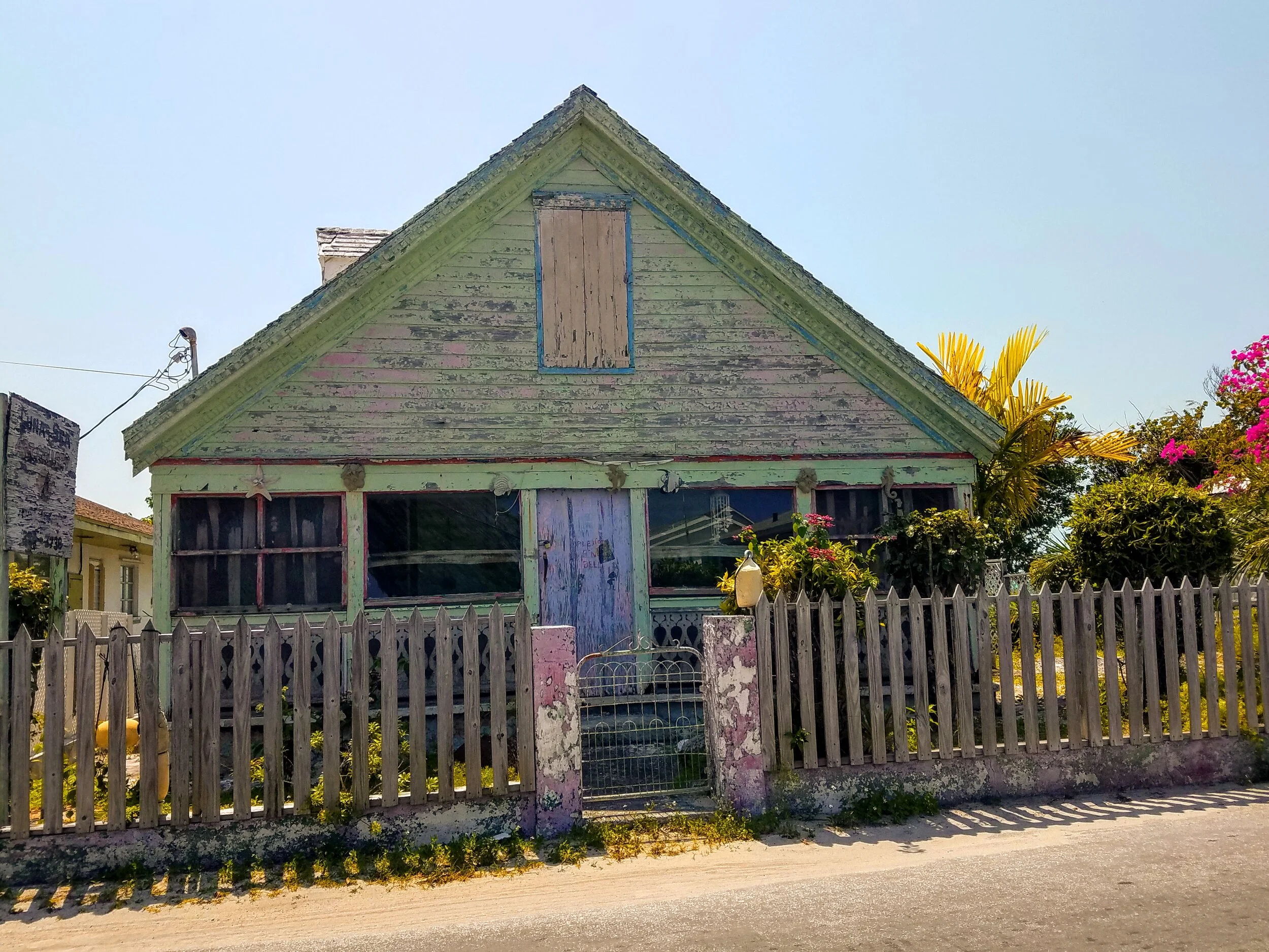
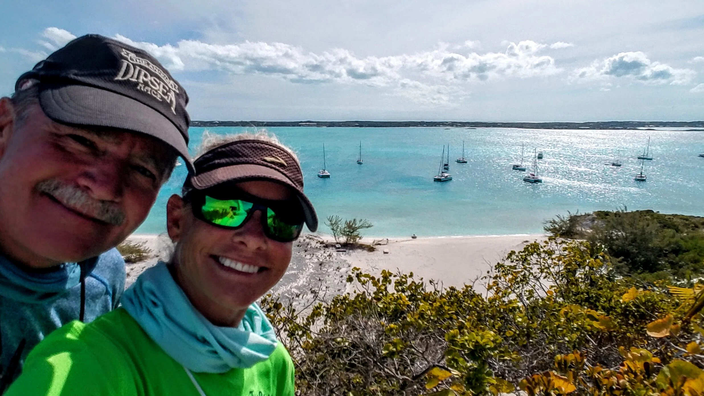
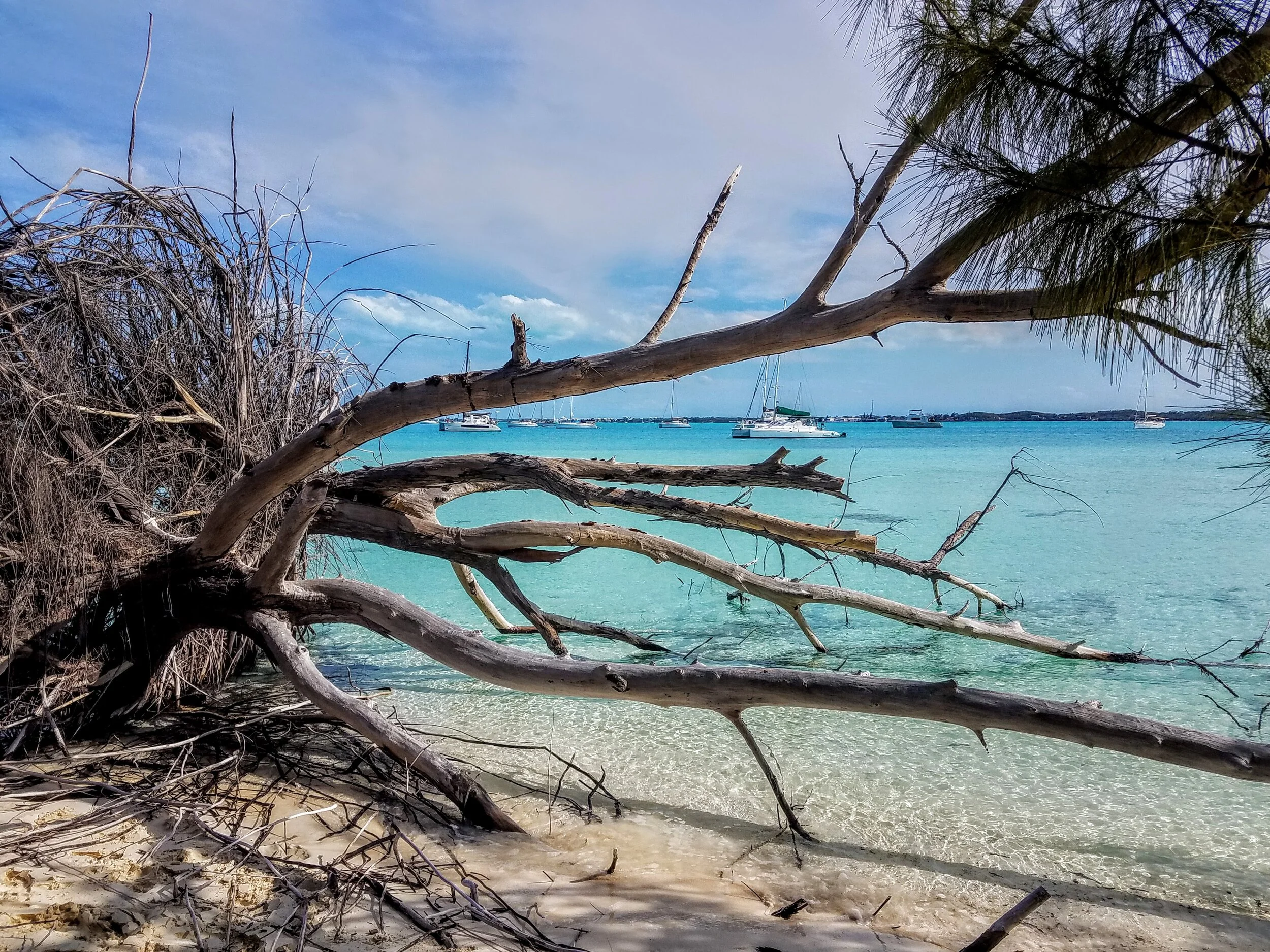
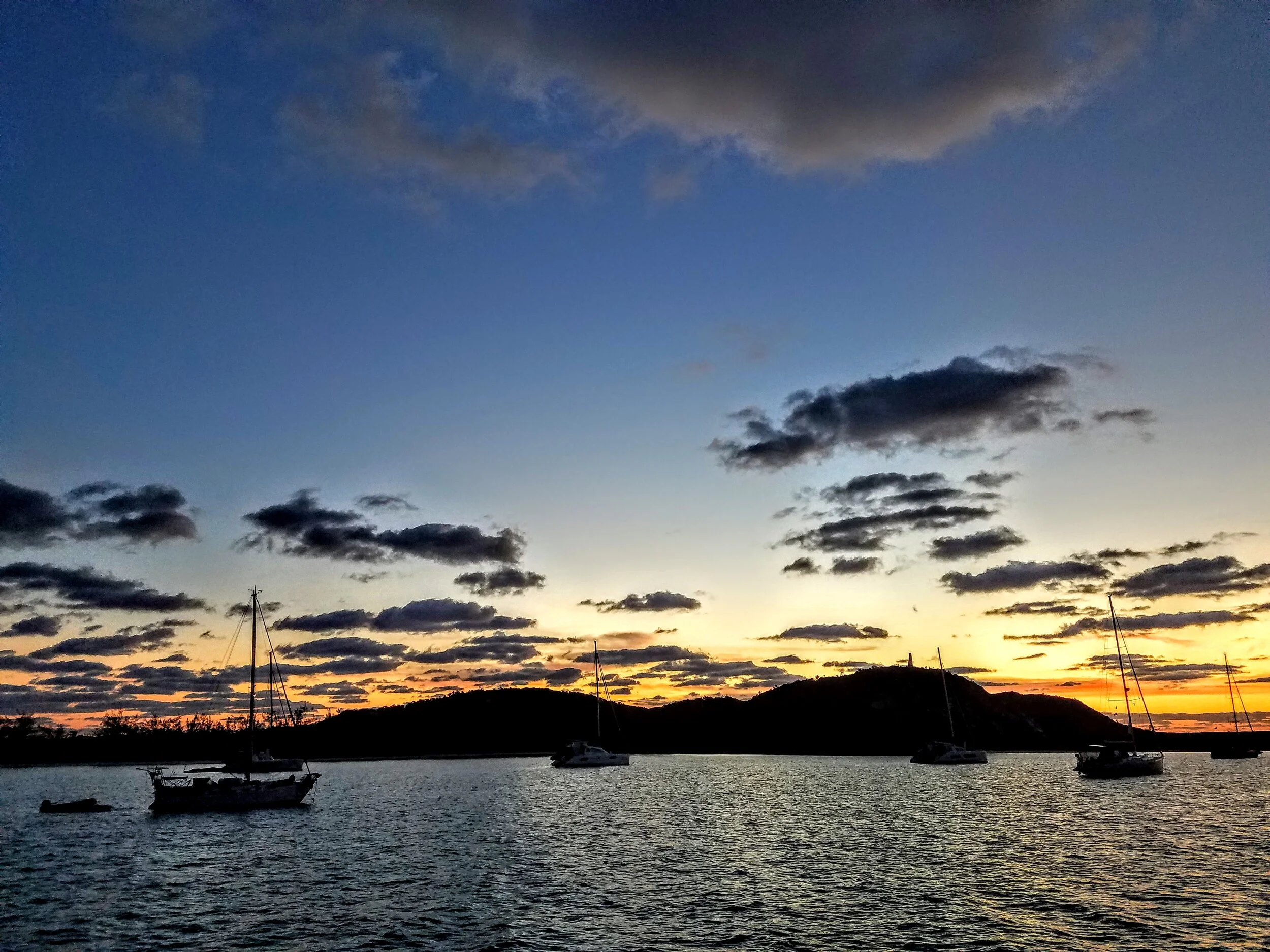
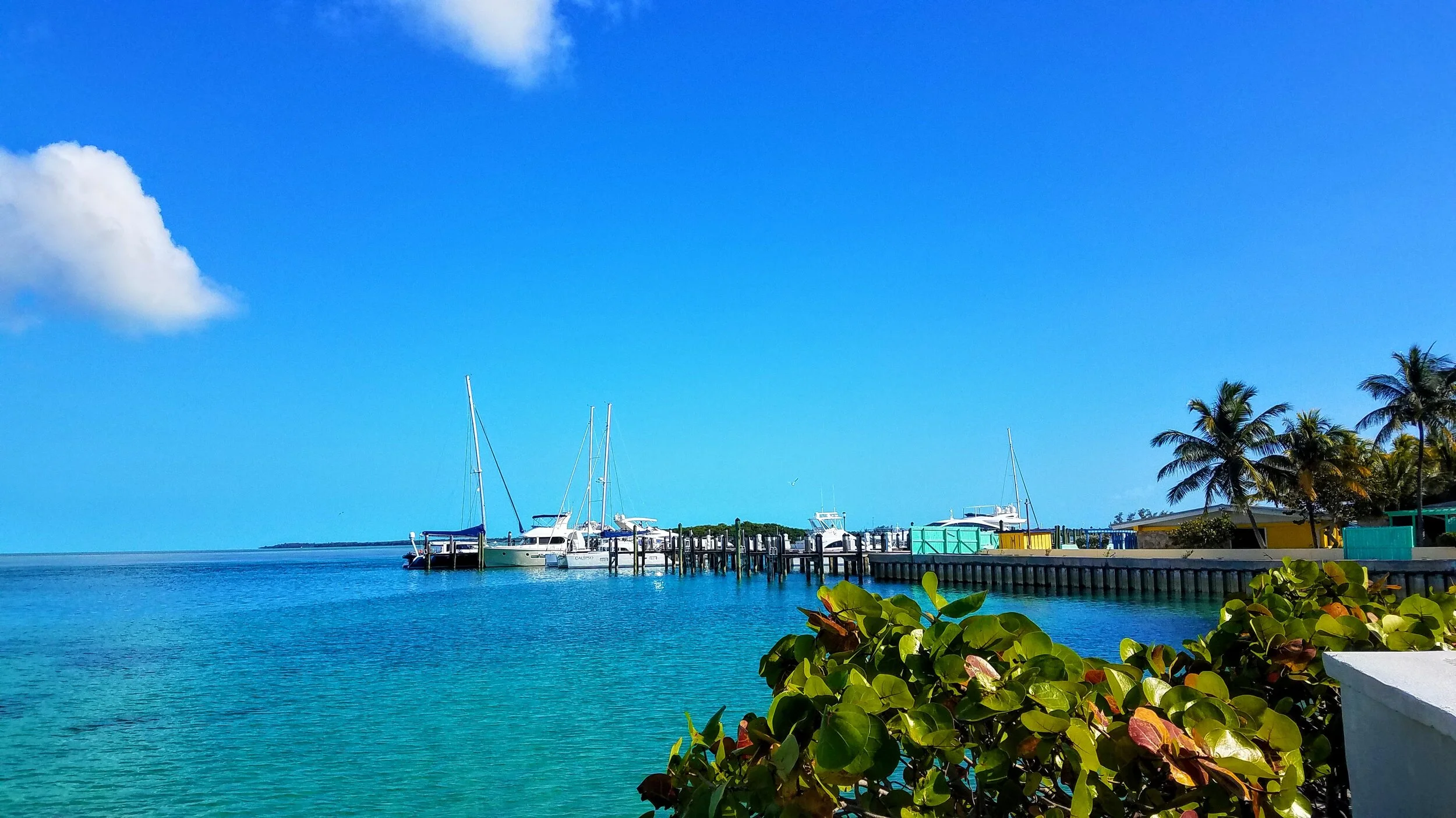
Placencia Bay, Belize
America's Great Loop and Beyond
Chronicles the voyages, big and small, of Larry and Jamie McCullough aboard their 59 foot Nordhavn, Coastal Pilot dubbed INDEPENDENCE. Upcoming trips to the Bahamas, The Great Loop and more. Much more as it turned out, but you can read about that in the ‘Log’.
With the first Independence sold, you think we might take a breath. But no, not Larry! We are now experiencing a first for both of us. Building a new boat with the manufacturer. Life Proof Boats “Built for Adventure/Safety/Life”. That’s the tag line on their web site http://www.lifeproofboats.com
We hope you will join us in the process and the adventure…

Placencia Bay, Belize
To those who might be thinking “why are we like a boomerang, always returning to Florida?”, I will now explain. When we left for the Bahamas our intention was to explore the islands and cays for a few months and then head north toward Maine and eventually put the Independence on a transfer ship in Rhode Island bound for the west coast. Well, as we began to spend days at anchor we realized that our batteries were not holding a charge very well. In addition, with the short, low RPM hops between anchorages we were also not able to use the engines to get them up to a full charge. This led us to using the generator more and more to keep the batteries charged and soon enough the writing was on the wall - a whole new battery array was soon to be in our future. This is not an unheard of event as boat batteries, like cars, must be changed every few years and it just so happened that now is the time for ours to be swapped out. So back to Florida we go. We arrive at ‘Nordhavn Central’, which is now Safe Harbor North Palm Beach Marina. After replacing the batteries we take advantage of being in Florida and have a little fun with our great friends Connie and Rich (thanks for making the drive across the state!). Now is the waiting game for when we can load the boat onto the transfer ship (now out of Fort Lauderdale). We will head back to Marin for a few weeks and hope for a load date around the first week of June. We are excited to think about receiving the boat in La Paz, Mexico and being able to explore Baja with all of our west coast friends and family. Well…that’s the plan any how!

The Garmin ‘inReach’ showing our track around the Bahamas and our ‘boomerang’ back to Florida

Larry and the Nordhavn crew removing the old batteries

We rented a truck to put the old batteries in for return….The larger of these batteries weigh 175 pounds each!!!

The entrance to the ICW and to Safe Harbor North Palm Beach Marina (at the white building) as seen from Parker Bridge

A baby Iguana tucked in a palm tree…the smallest one I have ever seen - less than a foot long

A little Tequila Tasting with Rich and Connie Dancaster on the back deck of the Independence
The winds have calmed and crossing to Bimini via the North Channel goes smoothly (74NM). We anchor at a nice little bay in front of Bimini and have a quiet night on the hook. Morning brings unexpected showers but not a great deal of wind and we are once again in clear skies within the hour. It is a good reminder of how to use our radar system and fog horn. Larry puts the fishing line in and catches a small Mahi Mahi, which he kindly releases to grow a bit bigger. We enter the Lake Worth inlet to crazy-busy Saturday marine traffic…sport fishers flying by, jet skis jumping boat wakes, paddle boarders & kayaks floating in the channel…who knew the most challenging part of the cruise would be getting from the inlet to the North Palm Beach Marina (77NM)

Bye, bye Bahamas…we will miss you

Getting a refresher course on the radar, etc.

Low visibility . Rainy but not windy.


An hour later and it’s like this….I will miss these beautiful waters
Saturday on the water in North Palm Beach, Florida

Frigate’s is a nice place to grab a cold one and you can take your tender to it

Safe Harbor North Palm Beach Marina…Nordhavn central!!!

Wish list…CP59 - 04 sister ship has a breast plate & bow anchor protector…#boatblingenvy
We leave Spanish Wells during a high tide in the late morning to get safely through their shallow and narrow channel. Larry does a ‘securite’ call to be sure that we do not have to share the channel with any large vessels. Unfortunately, some boats either don’t care or don’t have their VHF radio on, either way we end up having to defend our exiting position against a large sailboat motoring into the channel. The sailboat is kind enough to hold off their entry until we are safely out of the channel. We run across the bay, back to our Meeks Patch anchorage for the evening. The following day we have a nice cruise back to Chub Cay (61NM). We will stay at the marina here for a few days on a weather hold, as the winds are predicted to get upwards of 20 knots.

Sunset at Meeks Patch anchorage

Chub Cay in view after six hours of cruising

Boat wash done, time for a rum punch

Drawn to the freshwater of a boat wash our neighbors give the manatees a little back rub. Just like the Gray Whales of Baja, the manatees love a good scratch.


We have time on this visit to Chub Cay to grab a beer at the Nauti Rooster….

…and to smell the flowers of Chub Cay

Sunset over the marina

Super Moon rise over the marina

The lovely Chub Cay Club House

The mighty Marlin. Now, thankfully, catch & release

The pool & bar with the beach just steps away


The delivery boat at the mouth of the inner channel at Chub Cay

Fellow Nordhavn cruisers…Mermaid Monster….

….and Solway Coast arrive at the Chub Cay Marina


Triple threat…Nordhavns rule this end of the dock!

This was a ‘small world’ moment. The owner of this beautiful sport fisher, Steve Levy, knows my childhood friends in Jamaica!

My favorite ‘Laughing Gulls’ taking a swim in the pool

Larry enjoys the Tiki Bar

You don’t have to have a boat to get to Chub Cay…they have their own airport. We are here to check out of the Bahamas with immigration & customs

Crossing the channel from Meeks Patch to Spanish Wells (2NM) the mileage counter clicks over to 8,000 NM (actually, 8,500 if you include our previous trip to the Bahamas two years ago before we reset the counter). Just another notch on our Nordhavn belt.
We had tendered to town the day prior to get a feeling for the shallow entry to the marina and to get Kyle and Lindsey their five day COVID retest (negative). Entry to the marina is very shallow and must be navigated at high tide. We slide through fine and after tying up and washing the boat we head to the Wreckers bar for dinner and drinks. The next day we rent a golf cart and explore the neighboring Russell Island and then Kyle and Lindsey head out for Bonefishing the flats. Spanish Wells is known for its Bonefishing and anglers come here from around the globe to chase these fast and powerful fish. They are not for eating just for the thrill of the fight.
Spanish Wells got its name from the Spanish sailors who would stop here to refill their water supply prior to returning to Europe. The population is approximately 1,500 people and many can trace their lineage to the original shipwrecked individuals that found shelter in Preachers Cave six generations earlier. Later settlers were Crown Loyalists, who left the U.S. after the Revolutionary War.

Kyle opts for a Pina Colada at Wreckers…

…while Lindsey choses the Mud Slide

The lay of the island(s)

The sweet little homes of Spanish Wells….


They grow Pineapples on Eleuthera but they are strangely hard to find

A shipwreck theme i believe…

The oldest home on Spanish Wells

The strangest flower on Spanish Wells…

The beach at the end of Russell Island

The Sandbar Restaurant and Bar at Russell Island


Kyle and Lindsey prepare to enjoy the fish tacos at the Sandbar…beware of the ‘Goombay Smash’ Zombies!!!

Back on Spanish Wells we visit Budda’s Bar and meet the owners’ (Budda) daughter, Carmen. Later we meet Virginia Park who is a sixth generation descendant of the original shipwrecked people of Preachers Cave.

Budda’s has painted signs everywhere you look…


The golf cart rental appears to be a hit. Outside Budda’s Bar

The point at Spanish Wells

We met this nice couple, Jada & Cam, the previous night at Wreckers, then we saw them at lunch at the Sandbar, so we figured it only natural that they join us for dinner at Shipwrecks. Such a nice couple!

The last day and the obligatory picture on the swim platform

You have to take a water taxi to get to the car rental

We rent a car to tour areas south down to Governor’s Harbour (the capital of Eleuthera). Here we have stopped at The Glass Window. The most narrow section of Eleuthera where they placed a bridge to connect the span

A windy one out there

The view across the bay to Governor’s Harbour

A quick bight of Grouper Fingers and fries at this cute roadside restaurant

A last Kalik before leaving the Bahamas

After we drop Kyle and Lindsey at the airport we check out Preachers Cave

This is the cave where the shipwrecked people came for shelter. It is only a few yards from the sea.

The stone plaque says “William Sayle ship wrecked at Devil’s Backbone found refuge here. Sermons held 100 years”.

Natural openings in the cave ceiling give it a cathedral effect

The mouth of the cave looking ourtward

I thought this was humorous…

…It really did look like binoculars

Back to Spanish Wells via the water taxi

I finally used the last of the frozen lobster tails from Bimini for Lobster Tail Curry

Larry approved

A Spanish Wells Sunset
By Larry McCullough
It was a dark, stormy, rainy night, the visibility was down to 100 feet, the wind was blowing maybe up to 45 knots, the anchor dragged…
The night did not start out that way, quite contrary as a matter of fact. The wind was supposed to blow about 12 knots from the East to South East for the remainder of the night. We were in the bay at Black Point Settlement which provides excellent protection from winds coming from the East or South. The bay also has an excellent bottom for anchoring. Things were looking good for getting a good night’s sleep.
Earlier in the day we had heard about a storm ripping through Florida but it was not supposed to move as far east and south to where we were. At about 9:30 in the evening I started to get ready to go down to our stateroom and I noticed lighting way off on the horizon, many miles away. Still nothing in the reports of it coming this way. The wind was still coming from the south east, the boat pointed towards shore, all looked well.
I like and need my sleep. Jamie decided it best to sleep in the salon to keep an eye on the anchor watch. The distance evaporated over the hours and found it’s way to Black Point. I was sound asleep when I could hear Jamie come down the steps to our room, I could sense her moving quickly, I knew something was amiss*, she tells me we are dragging the anchor. As I said, I was sound asleep, I did not hear the thunder and the pounding rain. I ran up to our salon and looked at our Furuno screen and the boat had left the “Anchor Watch” (an alarm we set that lets us know if we leave a set radius that is set when we drop the anchor and activate the alarm) area and dragged, setting off our Anchor Alarm. I looked at the screen and we had totally changed direction, we had done a 180! We were now pointed to the North West with the very rocky shoreline now on our stern.
No need to splash cold water on my face, the rain was pounding outside and felt like needles poking at my face as Jamie and I ran to the bow to let out some more chain while hoping the anchor would reset on her own. The Anchor grabbed after being pulled out and I am sure the extra 40 feet of chain didn’t hurt. We now had about 140 feet of chain out now in about 10 feet of water, a very nice ratio (scope). Independence stayed clear of other boats, and them of us even though you could barely see them in the horizontal rain, thankfully.
Time to reset the snubber and get inside and dry off. I spent roughly the next hour staring at our screen and watching to see if the boat was holding via the GPS, it did. The winds calmed down and the squall/storm passed.
Later we heard some horror stories of boats hitting others and anchor lines being tangled and even a boat being grounded. Reports of the wind speed we heard were gust to 45 knots! I got back to sleep though for a couple of hours, that surprised me almost as much as the storm.
· Had to throw that word “amiss” in. Years ago a friend called me and told me to watch the “10 O’clock” news that night, he was going to be on it. We watched as he told the story of how he witnessed many police cars and an ambulance pull up to the house next door to him. But, he told the interviewer, “I knew something was amiss when the coroner pulled up”. Ok maybe it was the timing, either way I got a good laugh out of his description and usually that word brings a smile to my face.

The arc to the right is our original anchor swing. After the drag and reset you can see the new swing pattern

The yellow dots show the track of the anchor while dragging us across the harbor toward the rocky shore.
A quick hop from our anchorage at Rock Sound to one at Ten Bay (19NM) for a nice evening at anchor. The next day we decide to push a little further as the winds are coming from the south and that does bode well for anchoring in this area of Eleuthera. Larry navigates us to and through Current Cut which must be timed with a high tide as the approach can be five feet at low tide. We take it slow and steady and pass smoothly through the cut. On the opposite side the wind is still a bit of an issue for anchoring but we eventually find protection at Meeks Patch (45NM) right across from Spanish Wells.

Kyle catches his first Baracuda while underway to Ten Bay

This guy has some crazy teeth! Kyle releases him after his photo shoot.

My nephew! Always a star in my book…

Salty snacks after snorkeling in Ten Bay

Dolphins join us several times over the next few days

One can not return to the mountain town of Telluride without a Bahama tan

Current Cut ahead

As you can see by the chart, you must stay in the channel

The shallow water glows in front of Current Settlement

On final approach

The snorkeling at Meeks Patch was great

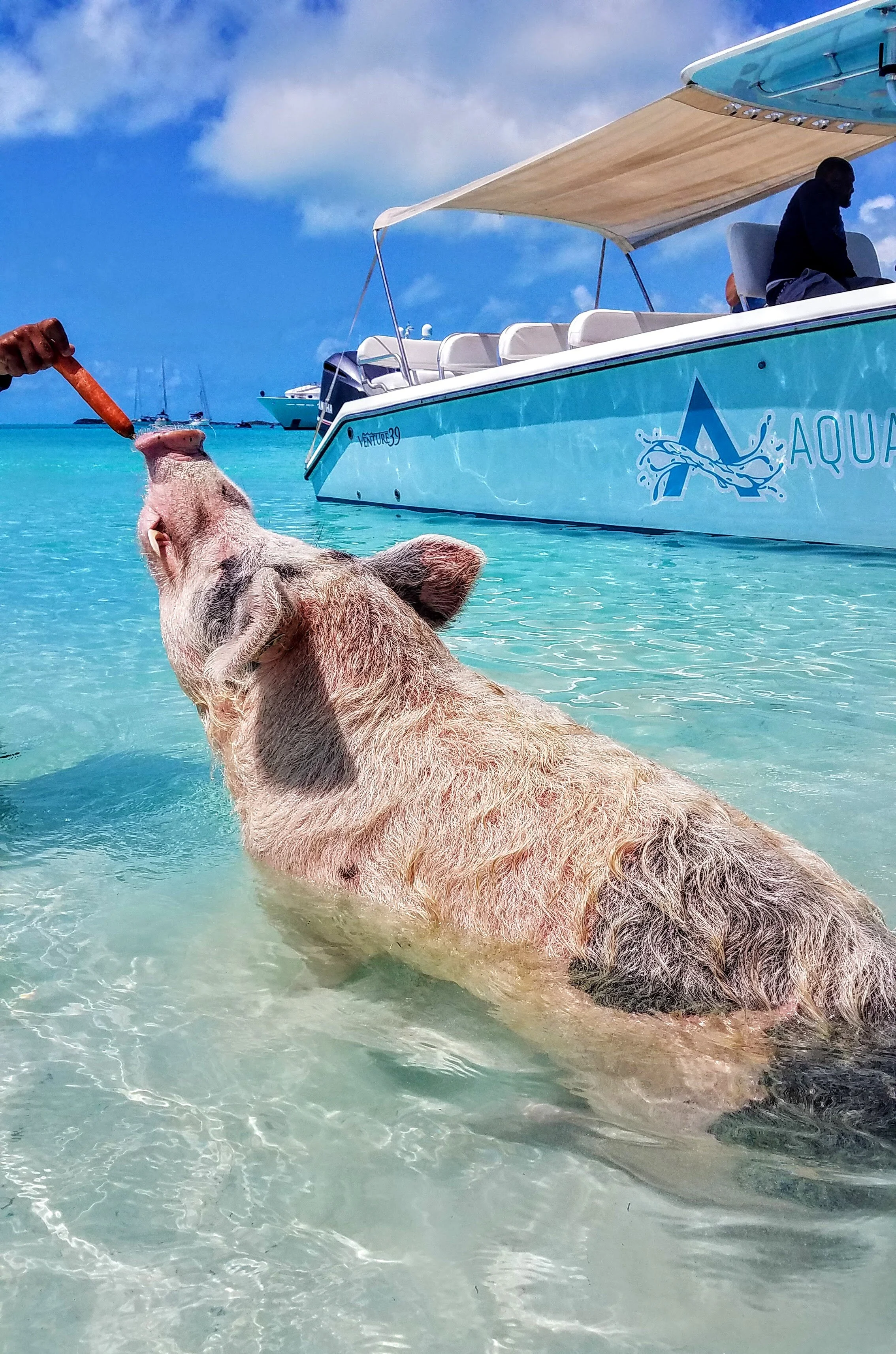
Meeks Patch is also another swimming pigs spot…this swimmer just had a litter of piglets about a week ago

They could not have been any cuter

Sandy snouts looking for carrots

A nice calm cruise to Cape Eleuthera {44NM} in calm water. The Marina and Resort is lovely and I do a bunch of laundry, get a couple jogs in and some beach time. Sleep has been somewhat elusive the last few nights and we are looking forward to a quiet night in a marina without the worries of anchoring. Of course, as fate will have it, the people on the boat next to us are having a 50th birthday party…well, that’s what a ‘white noise’ fan is for.
Eleuthera is a long and skinny archipelago made of one large island and several small cays. The first people thought to inhabit the area were Lucayan Indians, which were enslaved by the Spanish. After which, the island (according to a google search) was inhabited by Captain William Sayles and a group of Puritans from Bermuda looking for religious freedom. Eleuthera is derived from the Greek word for freedom.
We are joined by Kyle and Lindsey, who flew in from Colorado to the North Eleuthera airport and hired a car service to take them two hours south to us at the Cape Eleuthera Marina. We will cruise them back north over the next few days and hopefully have some adventures along the way. We are looking forward to a calm cruise to an anchorage at Rock Sound (33NM). But first, we must fish!!!

Sunset from Cape Eleuthera

The captain enjoys a little R&R on the beach

The Cape Eleuthera Marina and our friends boat Stella…nice to meet you Debbie & Dan!

No, that is not Larry enjoying a fruity cocktail…the ‘Goombay Smash’ has become a favorite.
Larry and Kyle getting pumped up for a fishing session…Larry ‘ups’ his game by placing his feet on the upper platform.

Fish on! Larry and Kyle take turns pulling it in.

This one is not getting away, as Kyle nets the Mahi Mahi/Dorado

Proud anglers

Kyle’s first Mahi Mahi/Dorado goes on ice while we cruise to Rock Sound

Just a few toys onboard this yacht in front of the marina

We leave the deep water of the Exuma Sound and head north

Kyle looks for fish

A little nap for the crew

Filleting lessons

Celebrating the catch with Tajin beers (also known as “a dirty ashtray'“)

Tendering to happy hour with Kyle & Lindsey

Larry, Kyle and Lindsey at the dock of Wild Orchid’s Waterfront restaurant & bar

The cute street view of the Wild Orchid’s Waterfront restaurant and bar

Kyle caught at least 20 of these little snapper. Too small to keep, they were all released
Pretty fish close up
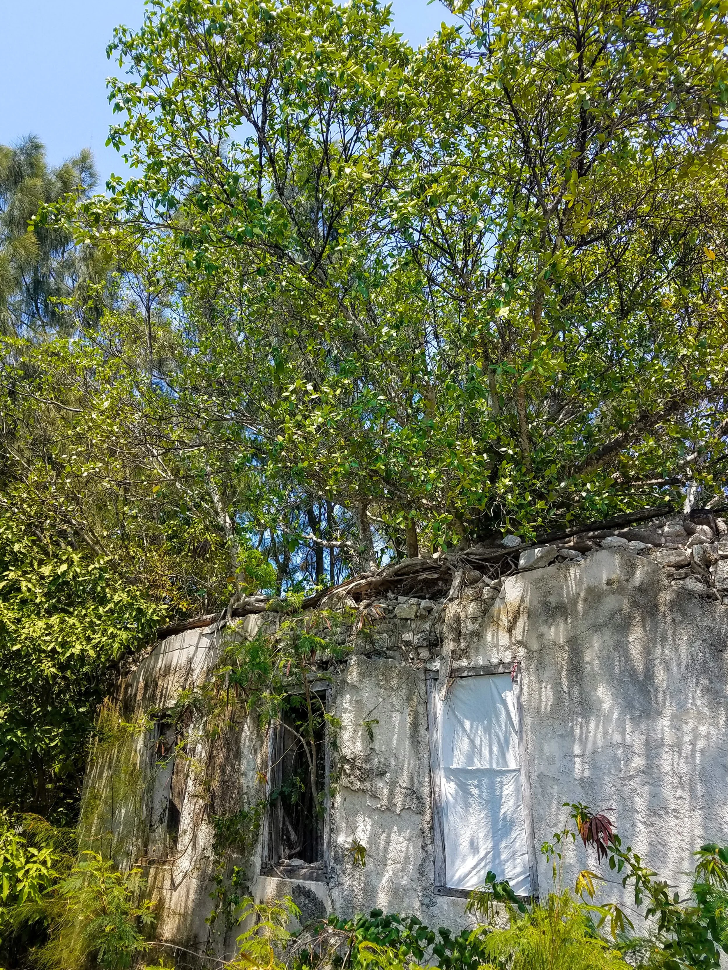
This little house in Rock Sound was taken back by the wilds

This little house is well loved

A quick walk to The Ocean Hole to get a peek of the 600 foot deep pool which is connected to the ocean through a series of underwater caves.

No fishing for poor Kyle…these fish are considered pets here at the Ocean Hole

The colors of Rock Sound settlement…

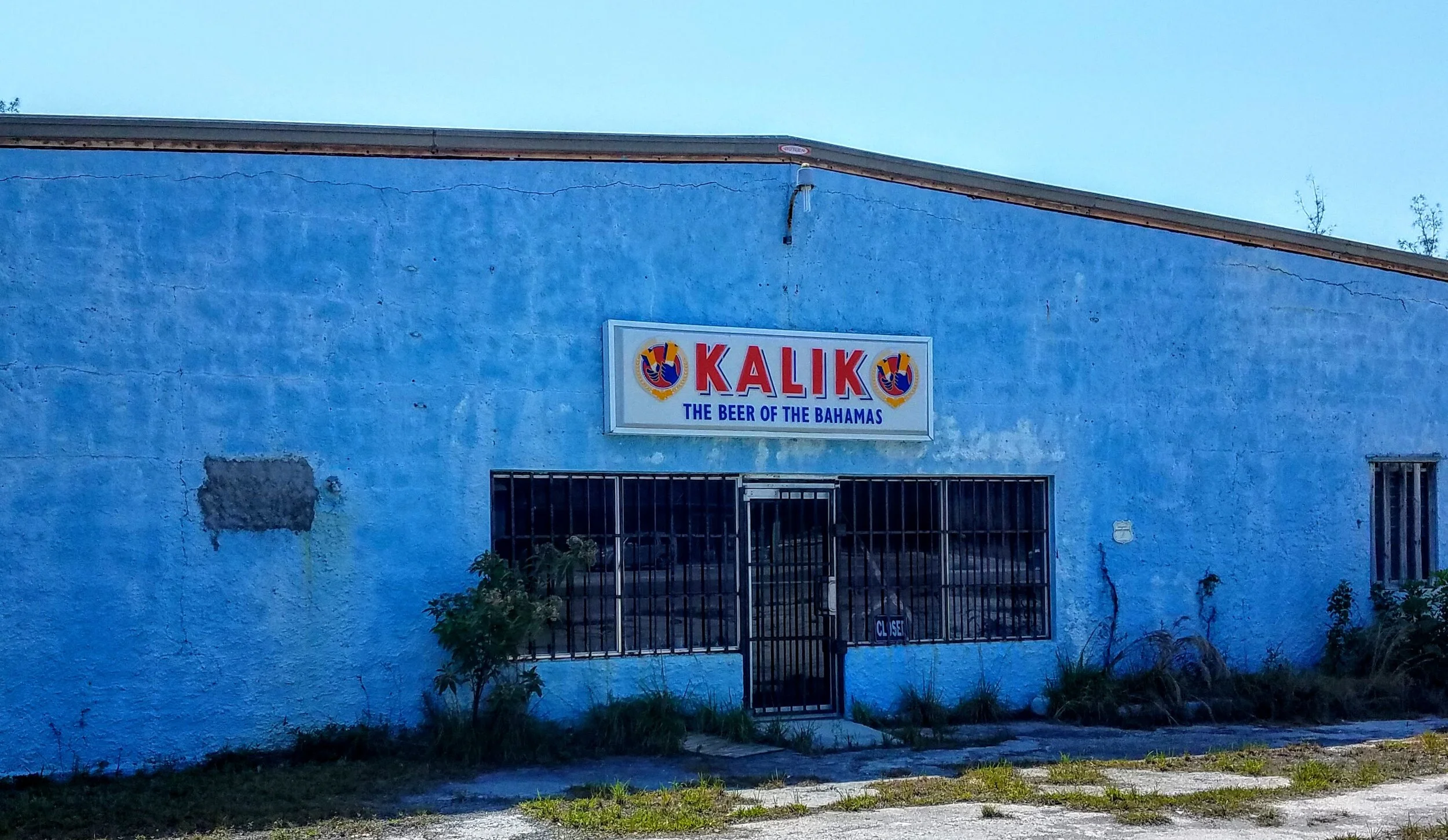
Our favorite Bahamian Beer!

An artistic rendering of the long archipelago that is Eleuthera
As nice as anchoring can be…it is all dependent on the weather. If the weather doesn’t cooperate it is not such a pleasant experience. That being said, the winds have shifted and so we pull anchor and get going early to find a more protected spot in the anchorage at Black Point Settlement. Once anchored we tender over to the dock at Lorraine’s Cafe and check out the friendly town. We have a cold beer at the Emerald Sunset View and then move onto Scorpio’s. D.J. at Scorpio’s is a great guy who we first heard advertising his bar on the VHF channel 16…”happy hour 4PM to 6PM Thursday, Friday & Saturday". We chat with him and a few other cruisers and then stop by Lorraine’s mom’s house to pick up our fresh-out-of-the-oven Coconut Bread and Cinnamon Bread…oh is that good!

The tender dock at Lorraine’s

Lorraine’s Restaurant & her mom’s sign for fresh bread

We were graciously invited in to get our bread. It smelled like my version of heaven in that kitchen. Larry shows off the two loaves of warm, dense bread and Lorraine’s mom graces us with a photo.

Emerald Sunset View Bar and Restaurant

Even Ice-T likes Scorpio’s

Leroy was the original owner of Scorpio’s. D.J., his nephew, runs the place now.

A little culture in between beers
One of the all wooden racing sloops that is made in this part of the Bahamas. They are made by hand with very few power tools. The regattas are held in April and the rules state that the sloops can not be over 28 feet, sails must be of canvas, hull of wood with a single wooden mast. They do not permit vertical transoms, bowsprits, spreaders, winches or any sort of wind or speed instruments including tell-tales (info from The Exuma Guide, Stephen J. Pavlidis)

The repairs on this sloop continue

You can see the Independence at anchor in the harbor and Larry with his two loaves of bread

Buffet night at Lorraine’s was great fun. Lorraine (pink shirt) and Burkie Wright (former police chief) posed with Larry and our cruiser friends Heather & Trent and Kim & John.
We start out early for a day trip back toward Dotham Cut and Hetty’s Land. It is a nice day with a mild wind and small waves so Larry decides to shake things up a little on this cruise and put out a line for trolling. We cut our speed a bit and within a hour I hear the reel run. Larry gives me the helm and starts his battle with the fish. We put the headsets on as it appears that this will not be a quick fight. I get him a deck chair and cut the port engine to reduce our speed but still keep course. Larry fights the fish for another half hour and then lets me know that I need to turn the boat into the waves (for stabilization) and come down and net the fish. He gets the fish to the swim platform but I can’t seem to net it, so I just grab the line and pull it on board. My job is done and I go back to driving the boat and leave Larry to dispatch the fish. From here the story is not as one would expect. The fish did not end up on my dinner plate. I guess that darn fish knew what a scupper was and while it was chased around the cockpit he slithered himself through the scupper and escaped back into the sea! It was a beautiful fish so I hope it survived his encounter with us…and we have a crazy fish story now.
The Dotham Cut is calm today and we rush through with the tide. Another hour and we are anchored at Hetty’s Land (55NM), a sweet little anchorage, that we have all to ourselves. There is truly something special about being at anchor, on your own. The only sound is the waves and the birds. We decide to sleep outside and as night falls the stars appear blazing from the horizon to the sky above.
The following day we take the tender to Oven Rock to explore the beaches and then ride over to Little Farmers Cay. A sweet, sleepy little stop with friendly people. Our friend Terry Bain from Ocean Cabin relayed the following to us…Little Farmers Cay was settled 165 years ago by freed slaves from Exuma. A woman by the name of Chrisanna Nixon and her children, James Michael Nixon and Adam & Eve Brown, bought all of the Cay and willed it to their descendents. Today approximately seventy permanent residents are their descendants.

On our way to the cut Larry hooks a fish and the fight begins

Time for a deck chair as this is not ending anytime soon

The beautiful fish appears…they call it Mahi Mahi here, Dorado or Dolphin Fish to others

Up on the swim platform. Photo by Larry

In the cockpit with Larry…the rest is history…

Anchored alone in Hetty’s Land

Oven Rock with a large Osprey nest (with chicks) at the top right

The tender anchored next to Oven Rock

A ‘coral-sand’ beach

View of the beach looking south toward Little Farmers Cay

Shipwreck on the beach

Conch shells in the north facing view with Oven Rock in the background

Little Harbour and fish hut at Little Farmers Cay

Always so welcoming

The view across Little Harbour

Ocean Cabin was most inviting. Larry had read that Little Farmers Cay is the only Cay/Island in the Bahamas to have their own flag. So when he ordered a couple Kalik beers from Terry he also asked if he could purchase a flag.

Terry is very proud of their flag and gave us the history and meaning behind the flag. He chatted with us until he had to go back to work…what an amazing person. Larry had him sign the flag and we left an Independence shirt for him at our next stop on Black Point Settlement at Lorraine’s...we hope he gets it!

The Ocean Cabin on Little Farmers Cay

Terry teaches us about the Little Farmers Cay flag over a Kalik (not too sure what happened to our pictures but they came out like this on Larry’s phone)
For safety's sake we stay at Emerald Bay Marina for another week waiting out the wind storm. We remove the canvas bimini from the flybridge and put out extra fenders and lines. The rain squall pelts and the winds howl for a full day peaking at 36 knots. Finally, the worst is past and we can head over to Stocking Island (11NM) to anchor out for a few nights. The grocery store across the bay at George Town is just a tender-ride away so we re-provision (as we can see that the produce boat has arrived). Obtaining fresh produce is rather a challenge in the Bahamas, as most islands do not have the land or soil for farming. With the fridge stocked we check out the islands more natural side. We tender over to a trial that takes you out to the Ocean beaches, followed by a hike up to the monument for the views.

The beginning of the blow

Sunset over the Marine Defense Force boat. You know the weather is bad when they come into the harbor.

The wind does not stop the party on the beach and my attempts to learn how to do the ‘Electric Shuffle’

Finally, calm water as we head out of the Emerald Bay Marina

Anchored at Stocking Island, Monument Beach
Be sure to anchor out of the channel as the mail/provisions boat has the right of way at all times

Entering the ‘Back Bay’ at George Town to access the grocery store

Views in the back bay

The church at the top of the hill

Back to the boat after provisioning

Friendly gulls…happy I didn’t get pooped on!

Sunset at anchor, Stocking Island, Monument Bay

Tender to the beach trail

Ocean views…

Sand dunes & surf

The monument at Monument Beach presumably used as a navigational beacon at one time

200 feet up provides a nice view of the monument beach & anchorage

The south view of Stocking Island
Independence at anchor amongst the sail boats

Some call it the ‘Salt Monument’

The north view of Stocking Island

A little house for sale on the beach
Wind blown trees with the boat in background

Monument Beach
Sunrise at the Monument Beach anchorage
So Sunday is family and friends day in the Bahamas. After church a trip to Stocking Island & hanging out at the Chat n’ Chill appears to be the next most popular thing to do. So the Porter Family and Larry & I drive to George Town and hop on Elvis’ Water Taxi for the short ride to Stocking Island. The water is calm, warm and clear. The people are so happy and friendly. The drinks are cold and best of all our friends are here to enjoy it with us!

The main beach at Stocking Island

The famous Chat ‘n Chill bar and restaurant

Dean & Larry have a cold one while enjoying the views

The conch hut

You can grab some of the throw-away conch meat and hand feed the rays that swim off the point. It looks & feels like you are feeding a ‘Roomba’ vacuum.

The Porter girls…Paige, Katie & Erin…I think Larry just lost his modeling gig

Larry & I hangin’ at the Chat ‘n Chill with Katie

Thanks for visiting Dean! You’re the best.

Elvis’ Water Taxi

A subtle reminder…

Happy 18th birthday to Paige

College buddies, Larry & Dean.

The chart for Dotham Cut
The term ‘cruising’ always sounds so laid-back. In reality, there is quite a bit of adrenaline involved. Larry certainly had his fill on the excursion out the Dotham Cut, then followed by the entrance to Emerald Bay Marina. I’ll start with the cut. A Cut is the term used for a break in the Cay or Island chain where you can pass from The Great Bahama Bank to the Exuma Sound and vice versa. What makes it interesting is that there is so much water passing through such a small opening that the currents and conditions can sometimes be quite treacherous. In addition, all that water moves and deposits sand into sand bars and shallow spots that you need to know in advance, so you can avoid said spots. On the way to Dotham we avoid the shallows by going out of our way and around them. When the cut came into view I really could not believe how small it looked and how rough the water appeared as it rushed the gap. I guess that is why that area is also called “White Horses”, as in white-capped waves. Larry entered the cut with a good throttle and continued to plow through the six to seven footers that were breaking very close together providing quite a bouncy ride out to the Exuma Sound. We had thought the wind might calm on this side but no such luck. A few hours later we make it to the entrance of the Emerald Marina (46NM) and once again find a very tiny opening with choppy wave sets that we will have to take on the beam. Larry again throttles and crab/surfs his way through the waves and then powers through the opening into the more protected waters of the marina. Now to wash the boat…again!

We avoid that pretty blue water where it is very shallow

That tiny opening in the middle of the image is Dotham Cut

Another view of the the cut

You can start to see the white water


The pictures never do the waves justice

This looks a little more like it…but still doesn’t fully capture the size nor the impact

The area called White Horses
Larry does a great job varying the throttle to reduce the impact in and pitching

The cut in the background

Love the clouds that reflect the green of the water

The tiny opening of Emerald Bay Marina above Larry’s right ear

Again, it is very hard to capture the sideways surfing of the boat while keeping forward motion to power through the current and waves into the marina opening…of course there are no channel markers

Once here…views are spectacular

A little bike ride…..

…but first I enjoy the view

Our friends The Porter’s are coming to visit Great Exuma and this is where they will be staying, Paradise Inn

The beach at Paradise Inn on Paradise Bay

A relative of the agave, this plant was used for hemp by local sailors back in the day

Parched…time to take a break at Big D’s

Larry always likes a corner seat and a cold one…the view is pretty good too

Only happy conch here in the Exumas
From Warderick Wells Cay we have just a short run to our anchor spot at Big Major ‘s Spot in the Bay of Pigs (16NM). Big Major’s Spot has a large salt pond in the interior that was, long ago, worked by the people on Staniel Cay. We are anchored, have the tender in the water and the snorkel gear on by noon. Larry locates the famous “Thunderball Grotto” where scenes from the Bond film, of the same name, were filmed. We tuck into the underhang of the grotto and are immediately surrounded by fish eager for their breadcrumbs. The cathedral-like ‘ceiling’ of this coral grotto has openings that allow the sunlight to stream in creating a truly spectacular experience. After the snorkel we check out the little Staniel Cay Yacht Club and a bit of the town. Most everything on the Cay is sadly still closed due to COVID. The following day we check out the swimming pigs. They are descendents of pigs that a Staniel Cay couple brought here many years past. The pigs are a really money maker now and draw many tourists every day.

The Independence anchored in the Bay of Pigs

A member of the welcome committee….nurse shark cruising for snacks

The backside of Thunderball Grotto

The entry of Thunderball Grotto

Thunderball Grotto. GoPro photo grab by Larry

The dingy beach at the Staniel Cay Yacht Club (SCYC)

SCYC

Larry enjoys a cold one at the SCYC after the snorkel

The nurse sharks gather when the fisherman throw them the scraps from the cleaned lobsters & fish

Feeding frenzy

Love my ‘nurses’! Photo by Larry

I have never seen so many mega yachts in active use in one spot before…every toy imaginable…tenders, jet skis, inflatable slides & climbing walls, hoverboards, etc.

The tender at the Pig Beach with the mega yachts in the distance

Poor piggy’s no cocktails for them

This droopy-eared pig was my favorite

The tour guides know what the pigs like and have trained them to sit for their treats
This big girl sits on command for her carrots. Larry mentioned that is hard to believe that they have such poor eyesight with all the carrots they eat!

Larry at the piggery with all the tired performers and the little piglets and their moms.

This happy pig some how scampered off with the whole loaf of white bread…still in the wrapper!

Another year around the sun calls for Rum Cake….and this little piggy liked it!
A short, smooth hop of just a couple hours cruise brings us to an anchorage at Warderick Wells Cay (23NM). Warderick Wells was once used by sailors as a source of fresh water and its coves a hiding place for pirates’ ships. It is now part of the Exuma Marine Park where all things are protected. We did not hear the pirate ghosts whisper or sing (as told in the Exumas guide book) but the views were magical enough.

Sunrise at Warderick Wells Cay

Thanks to Captain Larry and our Garmin you can see the route we have taken so far

Typical wardrobe for cruising…Sun protection - not COVID. Larry said I never looked better!
We depart Nassau via the east end of the main channel and cross to Norman’s Cay (42NM) between the Yellow and White Banks. This route allows us to find some deeper water…it’s amazing when 12 feet of water is considered deep! A nice calm cruise leads us to a pretty anchorage…time to put the tender in and check out Norman’s Cay.

My model advertising the CP59 cruising lifestyle

Anchored at Norman’s Cay and heading out for a snorkel

This is what is left of a DC3 airplane that crashed back in 1978

This photo (& the following information) of the same plane mentioned above, is courtesy of ‘The Exuma Guide’, by Stephen J. Pavlidis. Norman’s Cay was purchased by Carlos Lehder in 1979 for $500,000. He then spent $5 million in renovations, some of that going toward lengthening the airstrip and enlarging the dock. The improvements to the airstrip & dock were key to Lehder’s cocaine smuggling and distribution chain that ran from Medellin, Colombia to Norman’s Cay & then on to Florida & South Georgia. Strangely enough, the plane crashed attempting a touch & go maneuver with a load of landscaping sod.

The snorkel around the plane wreck was fantastic. The water was clear and calm and the fish - very friendly. Photo grab by Larry’s gopro
Another bouncy day of cruising in mostly three footers brings us to the island of New Providence and the Bay Street Marina in Nassau (36NM). We get our COVID retest (you must retest after 5 days in the Bahamas) and are happy with the negative results. This is the last ‘big’ city we will be in for awhile so we restock and prepare for more time at anchor. Most of the tourist area of Old Town Nassau is closed (due to COVID) but we find a few establishments and new friends to spend time with. The following day we walk over the Sidney Poitier bridge to check out the Atlantis Hotel and grounds. It is very much like stepping into a Las Vegas property…everything completely over the top. Again, it is very quiet these days but the friendly people on the property tell us that the tourism is starting to come back. The boom and bust cycle of the Bahamian islands is certainly a well known history and perhaps that is what makes the people that live here so very easy going and friendly.

Entering the west end of the main channel into the port of Nassau

The view of the Atlantis Hotel on Paradise Island across the channel from our marina

Nassau is where everything gets shipped to…if you look closely you will see the green four-wheeler on the bow of the innermost boat and a big screen TV going down the dock to a yacht.

Vintage photos of Nassau from the early/mid 1900’s

The municipal buildings and their statue of Queen Victoria

Larry gets a belated St. Patrick’s Day beer at Shenanigans bar…deserted Old Town in the background
So sad the straw market was closed…like many things, due to COVID

Our new friend ‘Captain ‘ Charlie (on the left) gets a private invitation into the Pirate Republic Brewery

A potent IPA…just a like a pirate, it takes no prisoners!

Just havin’ some beers with our new friends in Nassau

The view of The Atlantis and it’s shopping village from the top of the Sidney Poitier bridge

The grounds at The Atlantis

I was flabbergasted to see that The Atlantis has a Manta Ray in captivity. Her name is Hope and here she is doing a flip to hopefully get another bucket of krill from her caretaker. From what I understand, The Atlantis has a program to study the Manta Ray led by Mote Marine Laboratory. They tag, research and then release the rays (via helicopter!). I almost jumped into the tank to get a closer look…but Larry stopped me.

Hope, gliding by

Feeding paddles out and mouth open…Hope is hoping for more food

The aquarium at The Atlantis…like I mentioned…a little over the top

Really nice collection of fish…I love the Grouper, he was so inquisitive. Larry takes a photo of Hope (upper right).
Departing the port of Nassau via the east end of the main channel
We depart Bimini at first light with the intention of spending the night at an exposed anchorage in the North Channel 65NM away. The forecast was for two foot seas but that was not accurate as the waves were three foot and building by the time we arrived at our intended anchorage. We decide to proceed on to Chub Cay through the three and four footers. We were very happy to get to the marina after 11 hours on the water (86NM). Chub Cay is part of the Berry Islands chain and the Resort & Marina has become an upscale sport fishing club. I have never seen so many beautiful, tricked-out Sport Fishing yachts and as evening falls they are lit-up like Christmas trees. The affluence is quite evident everywhere you turn from the boats to the clubhouse to the well attired members. We enjoy the sunset at the clubhouse bar and then head back to the Independence for dinner and a good sleep.

Entering Chub Cay

The Chub Cay clubhouse

The obligatory compass rose

The clubhouse reception area…and Larry says I have too many throw pillows…

Poolside sunset at Chub Cay

The view of the marina and rows and rows of Sport Fishing Boats

Independence amongst the Sport Fishers
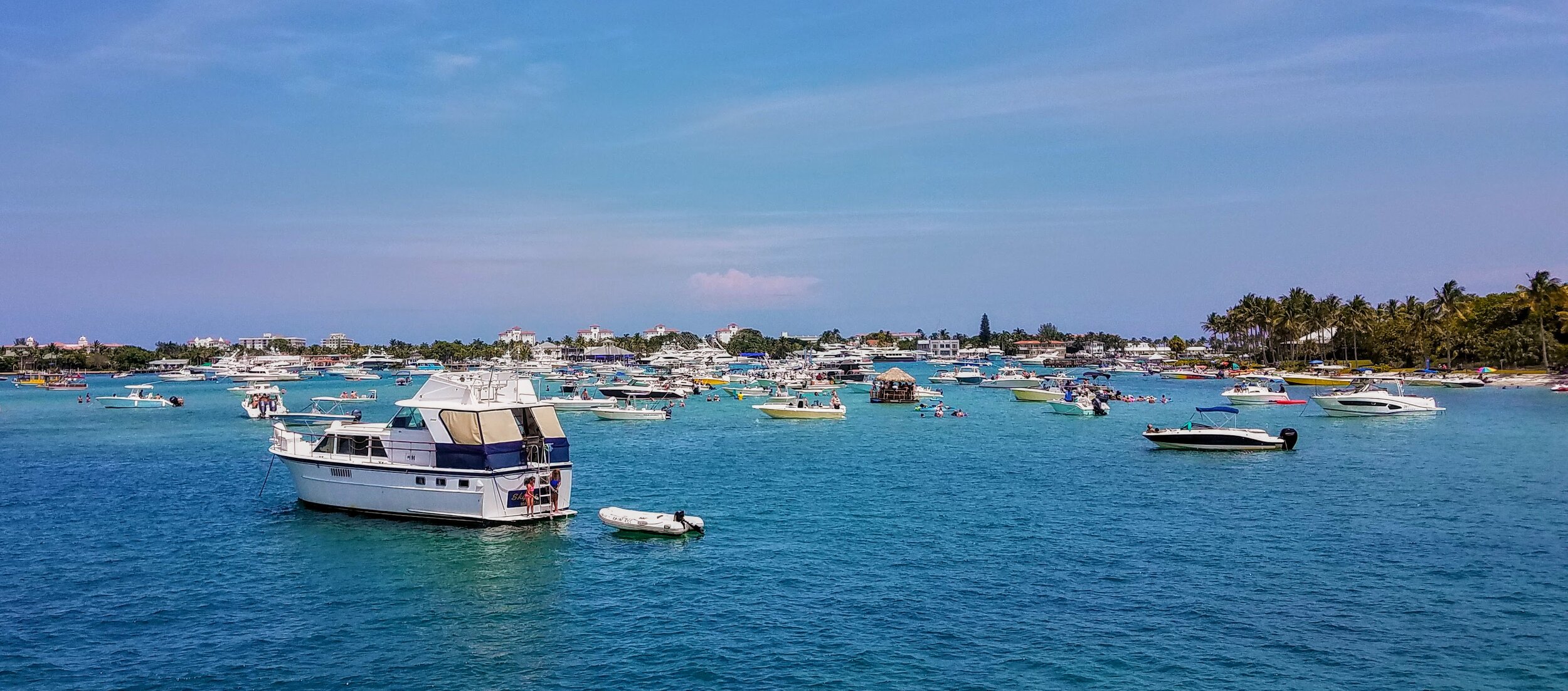
The trip to Bimini (55NM) went smoothly against a bit of a current. We left the dock around 7AM and were pulling into the channel at Bimini close to 2PM. Larry did an amazing job docking at The Big Game Club Marina. He had to deal with a three knot current on his bow while moving sideways and backwards into the slip, all the while dealing with very breezy conditions. The Harbor Master Ron & the guys on the dock were great and knew how to handle these everyday conditions. We spent the next hour checking in with Immigration and then Customs. All went well, as Larry had previously filled out our Travel Health Visas online and taken care of a majority of the paperwork in advance. After a quick wash of the boat we went to the local bar for an obligatory rum drink. Bimini is a sweet little spot with very friendly people that want you to relax and stay on their island. We rented a golf cart and drove the length of the island (5 miles)…oh by the way, they do drive on the opposite side of the road. It was evident that the COVID situation has had a great impact on the island but they are starting to reopen the tourist markets and some of the restaurants. Masks and hand sanitizing is a constant.
The history of Bimini is similar for much of the Bahamas with indigenous persons living on the islands and many enslaved after the New World Discovery in 1492. The first English settled on the islands in 1647. The 1650’s to the 1670’s were known as the “Golden Age of Piracy”. From the late 1600’s into the late 1700’s England and Spain fought over the islands with the British finally taking them 1783. In 1834 The Emancipation Act granted freedom to the enslaved. In 1964 the Bahamas became self governing.
The island of Bimini definitely saw its peak in the 1920’s. With prohibition in the U.S. people came to Bimini to drink and gamble, stay in nice hotels and catch huge fish. Many of the hotels stored the alcohol for transit back to the U.S….Rum-running. Hemingway spent time here in Bimini, writing and fishing as did many other big names of the day.

Departing Fort Lauderdale

Entering the channel at Bimini

Alice Town, Bimini, Bahamas
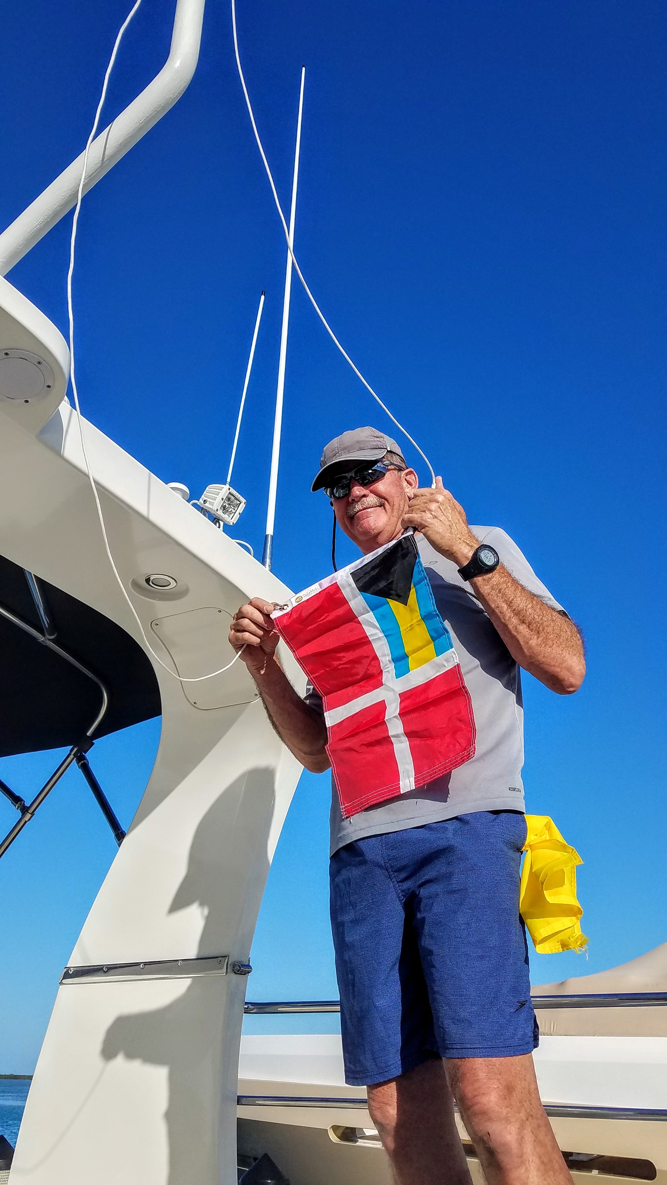
Raising the Bahamas Courtesy Flag after clearing immigration and customs

Look who we docked next to…Northland…our friends from the Bluffs at Jupiter, FL!

Time for a Rum Cocktail and ‘ruminating’ over days to come

Sunset at Big Game Marina

Eagle ray in the marina
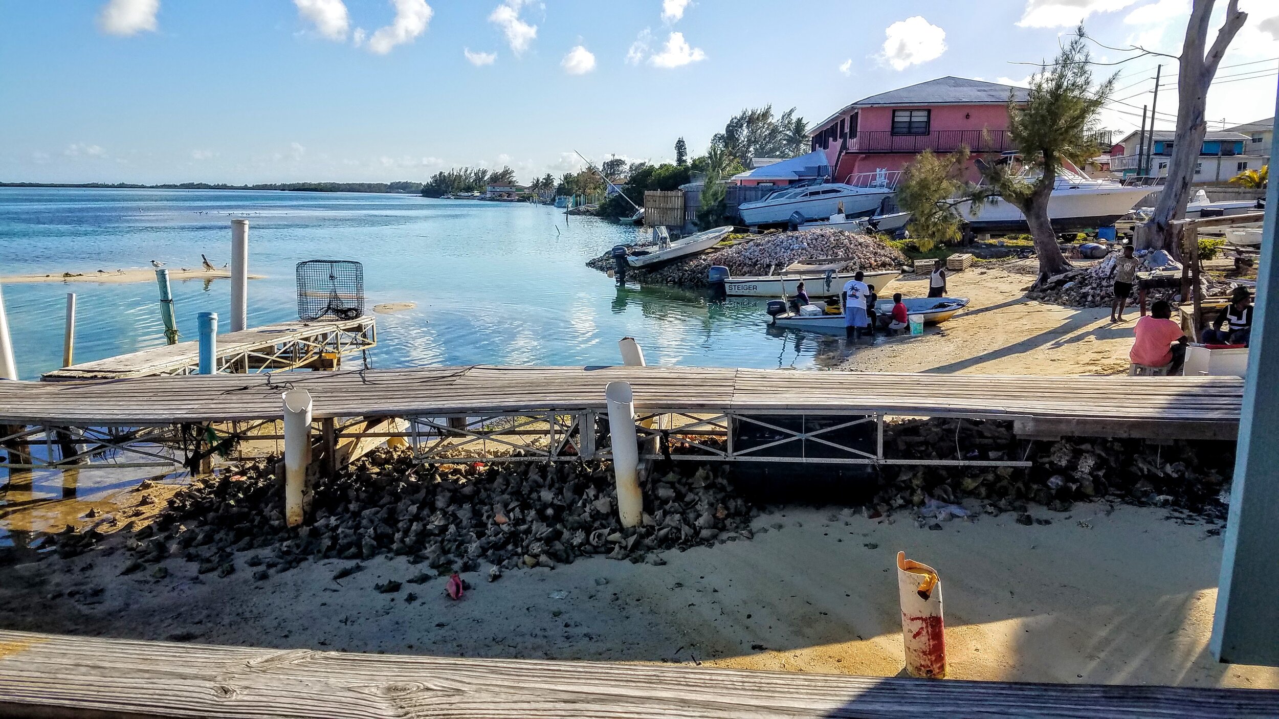
Conch fisherman and their spoils
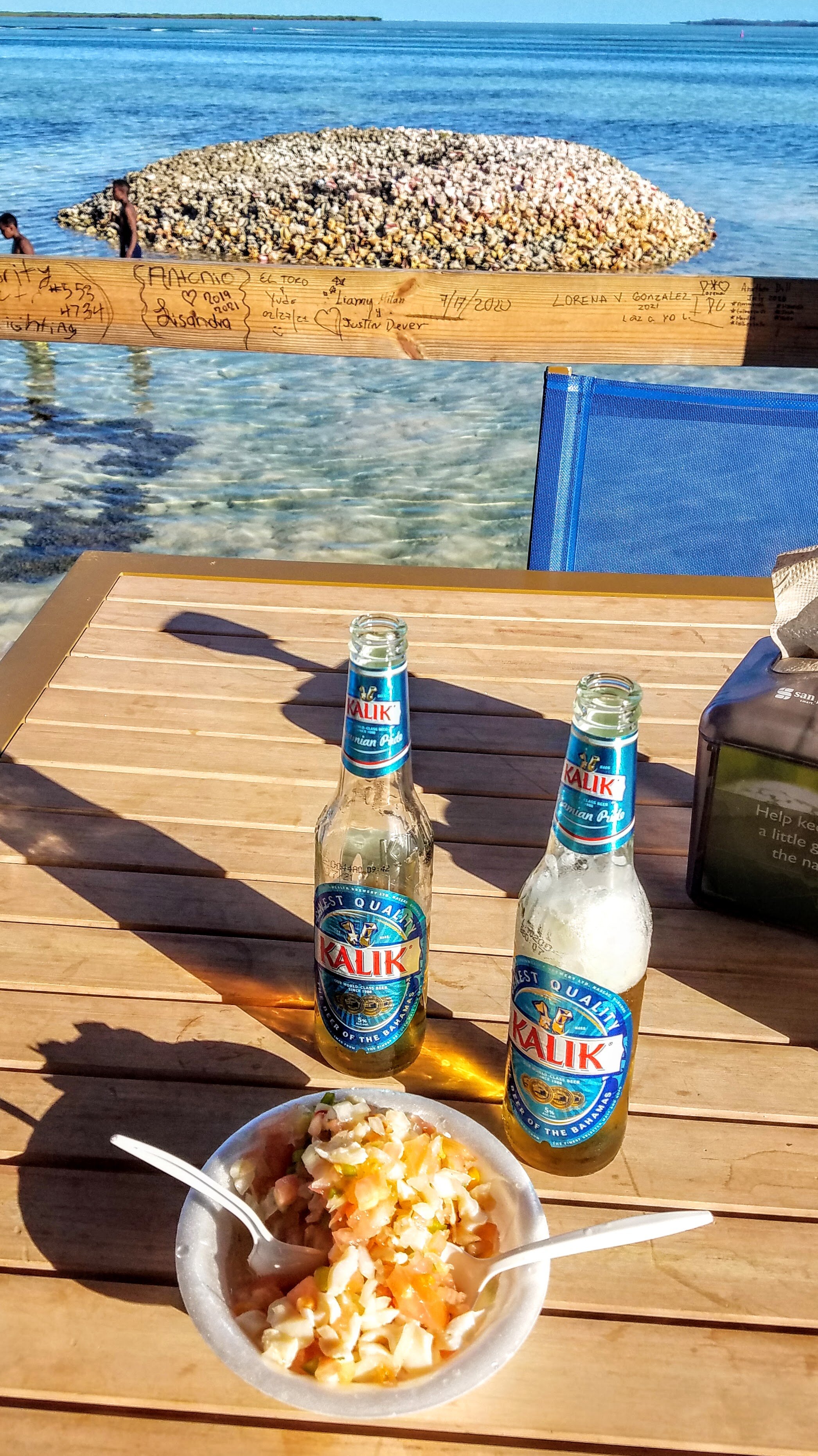
The famous Conch Salad at Stuart’s and the Bahamian beer Kalik

The hotel Hemingway used to stay at, The Complete Angler, was sadly destroyed by fire in 2006
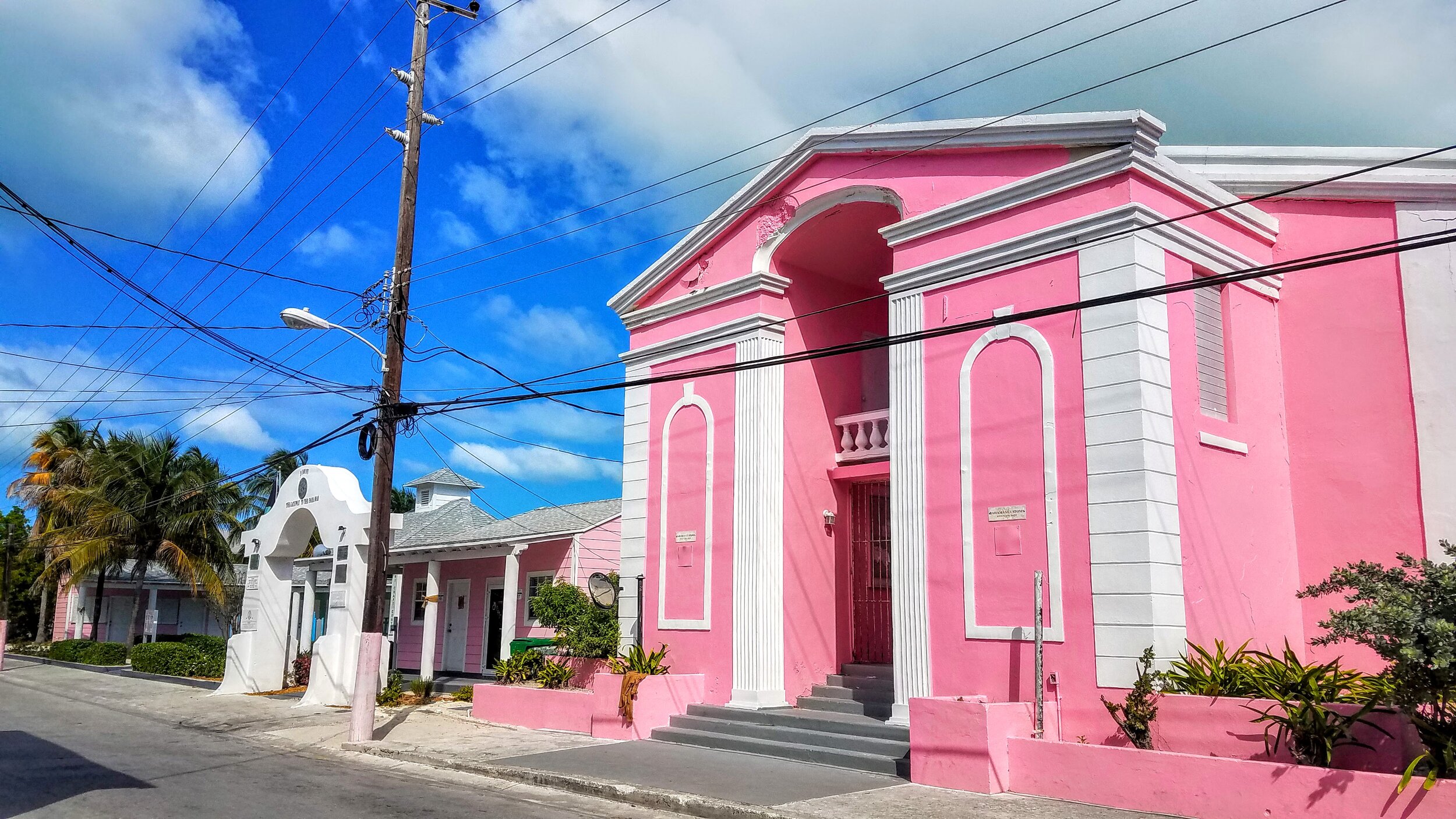
The original Customs House

A quiet place to rest at Sunset Point

Tide pool remnants
Views from Sunset Point Beach…


An old shipwreck off Sunset Point Beach
Independence at her siip in the Big Game Club Marina
The basic idea is to head to Bimini from Fort Lauderdale where we will check-in with customs and immigration. Next we will head to Chub Cay & Nassau for our 5 day COVID retest. After that we will cruise to the Exumas and Emerald Bay Harbor and then Cat Island and Eleuthera. We hope to cross the channel to Abaco and work our way to the Northern Bahamas by late May. This, of course, is just a plan and we all know what happens when you make plans….

Our route in highlighter